Import a GPX file

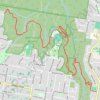
Wahroonga trails

Click on a trail to view its statistics, map and profile.

Wahroonga Reserve

Australia > New South Wales > Sydney

#Hiking #Wahroonga

Distance: 7.4 mi • Elevation gain: 385 m • Maximum elevation: 170 m

Gear up for your next adventure:

🗺️Topographic Maps - Detailed maps showing elevation and terrain features
🥤Collapsible Water Bottles - Save space in your rucksack as you consume your water
⛺Camping Shelters - Emergency and lightweight shelters for outdoor use
📍Handheld GPS Navigators - Reliable satellite navigation for hiking and off-road exploration
🧗Locking Carabiners - Secure gear to your pack or for light technical use

As an Amazon Associate, this site earns from qualifying purchases at no extra cost to you.