Import a GPX file

OsborneBay trails

Click on a trail to view its statistics, map and profile.
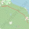
Osborne Bay Regional Park - Blue Trail

Canada > British Columbia > Cowichan Valley Regional District > North Cowichan

North Cowichan Municipal Forest Reserve. #Hiking #Running #OsborneBay #NorthCowichan

Distance: 5.4 mi • Elevation gain: 433 m • Maximum elevation: 246 m

Gear up for your next adventure:

🍳Camping Stoves - Compact stoves for outdoor cooking
🔦LED Camping Lanterns - Illumination for reading maps inside your tent at night
🥤Hydration Bladders - Hands-free hydration systems for backpacks
🚲Cycling GPS Computers - Track elevation and topographic routes on two wheels
🔋Solar Power Banks - Keep your GPS and phone charged during multi-day expeditions

As an Amazon Associate, this site earns from qualifying purchases at no extra cost to you.