Import a GPX file

Maguire trails

Click on a trail to view its statistics, map and profile.

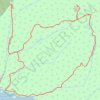
Mount Maguire

Canada > British Columbia > Capital Regional District > Juan de Fuca Electoral Area

East Sooke Regional Park. #Hiking #Loop #Maguire #EastSooke

Distance: 5.6 mi • Elevation gain: 375 m • Maximum elevation: 253 m

Gear up for your next adventure:

📦Dry Bags - Waterproof bags to protect gear from rain
❄️Walking Crampons - Added traction for icy slopes and winter peak bagging
🌄Outdoor Binoculars - Compact binoculars for landscape observation
🎒Hiking Backpacks - Comfortable backpacks for day hikes and multi-day treks
🔋Rechargeable Batteries - Eco-friendly power for headlamps and older GPS units

As an Amazon Associate, this site earns from qualifying purchases at no extra cost to you.