
LinleyValley trails
Click on a trail to view its statistics, map and profile.
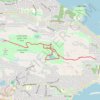
Linley Valley Cottle Lake Park
Canada > British Columbia > Regional District of Nanaimo > Nanaimo
Vancouver Island. #Hiking #Loop #LinleyValley #CottleLake #Vancouver
Distance: 6.0 mi • Elevation gain: 210 m • Maximum elevation: 184 m

Linley Valley Park - Lost Lake - Cottle Lake
Canada > British Columbia > Regional District of Nanaimo > Nanaimo
Vancouver Island. #Hiking #Running #Loop #LinleyValley #Vancouver
Distance: 6.9 mi • Elevation gain: 260 m • Maximum elevation: 219 m

Linley Valley Park
Canada > British Columbia > Regional District of Nanaimo > Nanaimo
Vancouver Island. #Hiking #Running #Loop #LinleyValley #Vancouver
Distance: 2.7 mi • Elevation gain: 113 m • Maximum elevation: 184 m