Import a GPX file

Hanes trails

Click on a trail to view its statistics, map and profile.

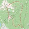
Hanes Valley Loop

Canada > British Columbia > Metro Vancouver Regional District

Lynn Headwaters Regional Park. #Hiking #Loop #Hanes #Lynn

Distance: 15.3 mi • Elevation gain: 1,327 m • Maximum elevation: 1,293 m

Gear up for your next adventure:

🔦Outdoor Torches - Reliable torches for night navigation
🧤Waterproof Overmitts - Extreme weather protection for hikers and mountaineers
📍Handheld GPS Navigators - Reliable satellite navigation for hiking and off-road exploration
🗺️Ordnance Survey Maps - Essential paper maps for hiking across the UK national parks
🧥Softshell Jackets - Breathable jackets for active outdoor use

As an Amazon Associate, this site earns from qualifying purchases at no extra cost to you.