Import a GPX file

EastKiewa trails

Click on a trail to view its statistics, map and profile.

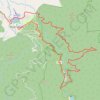
East Kiewa River Trail - Bogong Railhead Track

Australia > Victoria > Mount Beauty

Alpine National Park. #MTB #Loop #EastKiewa #Alpine

Distance: 22.1 mi • Elevation gain: 1,336 m • Maximum elevation: 707 m

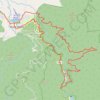
East Kiewa Valley - Mount Beauty

Australia > Victoria > Mount Beauty

#MTB #Loop #EastKiewa

Distance: 23.1 mi • Elevation gain: 1,339 m • Maximum elevation: 720 m

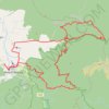
East Kiewa Valley

Australia > Victoria > Mount Beauty

#MTB #Loop #EastKiewa

Distance: 43.7 mi • Elevation gain: 2,980 m • Maximum elevation: 1,200 m

Gear up for your next adventure:

🥾Men's Waterproof Hiking Boots - Durable footwear with deep lugs for muddy and rocky UK terrains
🧭Orienteering Compasses - Accurate compasses for map-based navigation
🥾Hiking Boot Waterproofing Wax - Maintain the lifespan of your leather trekking boots
🧢Thermal Beanie Hats - Prevent heat loss from the head in windy summit conditions
🧤Thermal Touchscreen Gloves - Stay warm while operating your GPS or smartphone camera

As an Amazon Associate, this site earns from qualifying purchases at no extra cost to you.