Import a GPX file

Bunyip trails

Click on a trail to view its statistics, map and profile.

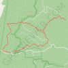
Four Brothers Rocks - Bunyip State Park

Australia > Victoria > Melbourne > Gembrook

#Hiking #Loop #Bunyip

Distance: 8.4 mi • Elevation gain: 529 m • Maximum elevation: 413 m

Gear up for your next adventure:

🧢Waterproof Hiking Hats - Keep the rain off your face while studying topographic maps
🎒Replacement Sternum Straps - Repair parts for hiking rucksacks
🛌Insulated Sleeping Mats - Crucial thermal protection when sleeping on cold, uneven ground
🧣Neck Gaiters - Protects against wind and sun on exposed ridges and peaks
🖼️Topographic Map Art - Decorative 3D-effect posters of famous UK peaks and regions

As an Amazon Associate, this site earns from qualifying purchases at no extra cost to you.