Import a GPX file

Buntzen trails

Click on a trail to view its statistics, map and profile.
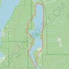
Buntzen Lake Trail

Canada > British Columbia > Metro Vancouver Regional District > Anmore

#Hiking #Loop #Buntzen

Distance: 7.9 mi • Elevation gain: 507 m • Maximum elevation: 222 m

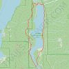
Buntzen Lake Loop

Canada > British Columbia > Metro Vancouver Regional District > Anmore

Buntzen Lake Recreation Area. #Hiking #Running #Loop #Buntzen

Distance: 6.2 mi • Elevation gain: 308 m • Maximum elevation: 222 m

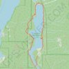
Buntzen Lake Loop

Canada > British Columbia > Metro Vancouver Regional District > Anmore

Distance: 7.1 mi • Elevation gain: 422 m • Maximum elevation: 270 m

Gear up for your next adventure:

🧤Thermal Touchscreen Gloves - Stay warm while operating your GPS or smartphone camera
💧Hydration Reservoirs - Convenient water bladders for hands-free drinking on the move
🕶️Polarized Sunglasses - Reduces glare from snow and water when reading terrain
🍲Portable Camping Stoves - Fast-boiling stoves for hot meals on remote topographic survey trips
⌚GPS Outdoor Watches - Watches with GPS tracking for hiking and exploration

As an Amazon Associate, this site earns from qualifying purchases at no extra cost to you.