Import a GPX file

BlackTusk trails

Click on a trail to view its statistics, map and profile.

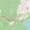
The Black Tusk - Garibaldi Lake

Canada > British Columbia > Squamish-Lillooet Regional District > Area D (Elaho/Garibaldi)

Garibaldi Provincial Park. #Hiking #Loop #BlackTusk #Garibaldi

Distance: 16.7 mi • Elevation gain: 1,992 m • Maximum elevation: 2,169 m

Gear up for your next adventure:

📱Phone Mounts for Hiking - Secure mounts to carry your phone on trails
🧢Waterproof Hiking Hats - Keep the rain off your face while studying topographic maps
🧺Ultralight Dry Bags - Organize and waterproof your gear inside your rucksack
🗺️Ordnance Survey Maps - Official UK maps for walking and outdoor activities
🪓Outdoor Multitools - Versatile tools for hiking and camping

As an Amazon Associate, this site earns from qualifying purchases at no extra cost to you.