Import a GPX file

AbrahamsBosom trails

Click on a trail to view its statistics, map and profile.
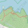
Abrahams Bosom Reserve

Australia > New South Wales

#Hiking #Loop #AbrahamsBosom

Distance: 3.5 mi • Elevation gain: 92 m • Maximum elevation: 27 m

Gear up for your next adventure:

🗺️Topographic Maps - Detailed maps showing elevation and terrain features
🗺️Scratch-off Peak Maps - Track your progress climbing Munros or Wainwrights
🔦Head Torches - Hands-free lighting for hiking and camping
👕Merino Base Layers - Natural temperature regulation for cold weather hiking and camping
🥾Men's Waterproof Hiking Boots - Durable footwear with deep lugs for muddy and rocky UK terrains

As an Amazon Associate, this site earns from qualifying purchases at no extra cost to you.