
Washington trails
Click on a trail to view its statistics, map and profile.

Grapevine, Church Rocks, Spanish Wash and Bracken's Trails Loop in Red Cliffs National Conservation Area
United States > Utah > Washington County > Washington
Distance: 10.6 mi • Elevation gain: 336 m • Maximum elevation: 1,101 m
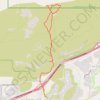
Grapevine Wash and other trails
United States > Utah > Washington County > Washington
Distance: 6.9 mi • Elevation gain: 166 m • Maximum elevation: 1,119 m