Import a GPX file

Winona County trails

Click on a trail to view its statistics, map and profile.

Whitewater State Park - Chimney Rock, Inspiration Point and Coyote Point loop

United States > Minnesota > Winona County > Elba Township

Distance: 3.3 mi • Elevation gain: 195 m • Maximum elevation: 341 m
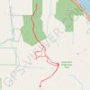
King's Bluff Overlook

United States > Minnesota > Winona County

Hike to King's Bluff Overlook via Park Road and King's Bluff Trail in the Great River Bluffs State Park and the King's and Queen's Bluffs Scientific and Natural Area. #Hiking #Nature #Forest #River #Park

Distance: 4.0 mi • Elevation gain: 110 m • Maximum elevation: 393 m

Other places

Gear up for your next adventure:

🔥Reusable Hand Warmers - Maintain dexterity in your fingers for precise map handling
📷Camera Straps - Secure straps for carrying cameras while walking
📻Hand-Crank Emergency Radios - Stay updated on weather warnings in remote areas
🎒Backpack Rain Covers - Universal waterproof covers to protect your gear from downpours
📍Handheld GPS Navigators - Reliable satellite navigation for hiking and off-road exploration

As an Amazon Associate, this site earns from qualifying purchases at no extra cost to you.