Import a GPX file

North Rim trails

Click on a trail to view its statistics, map and profile.
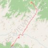
Bright Angel Trailhead via North Kaibab Trail and Bright Angel Trail

United States > Arizona > Coconino County > North Rim

Distance: 24.5 mi • Elevation gain: 3,122 m • Maximum elevation: 2,552 m

Gear up for your next adventure:

💧Hydration Reservoirs - Convenient water bladders for hands-free drinking on the move
🧰Survival Kits - Emergency tools for remote environments
📱Rugged Phone Cases - Heavy-duty protection for smartphones used as secondary GPS tools
🧥Waterproof Hiking Jackets - Rain protection for walking in all weather conditions
🗺️Ordnance Survey Maps - Essential paper maps for hiking across the UK national parks

As an Amazon Associate, this site earns from qualifying purchases at no extra cost to you.