
Hart trails
Click on a trail to view its statistics, map and profile.
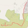
Castle Bottom
United Kingdom > England > Hampshire > Hart > Eversley Cross
Distance: 2.1 mi • Elevation gain: 43 m • Maximum elevation: 91 m
Click on a trail to view its statistics, map and profile.
United Kingdom > England > Hampshire > Hart > Eversley Cross
Distance: 2.1 mi • Elevation gain: 43 m • Maximum elevation: 91 m
As an Amazon Associate, this site earns from qualifying purchases at no extra cost to you.