Import a GPX file

Gillamoor trails

Click on a trail to view its statistics, map and profile.
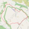
Gillamoor loop walk

United Kingdom > England > North Yorkshire > Gillamoor

Distance: 5.5 mi • Elevation gain: 185 m • Maximum elevation: 212 m

Gillamoor MTB Loop

United Kingdom > England > North Yorkshire > Gillamoor

Distance: 8.8 mi • Elevation gain: 374 m • Maximum elevation: 314 m

Gear up for your next adventure:

🗺️Ordnance Survey Maps - Essential paper maps for hiking across the UK national parks
🧤Hiking Gloves - Warm and durable gloves for cold-weather walks
🕶️Polarized Sunglasses - Reduces glare from snow and water when reading terrain
🥾Men's Waterproof Hiking Boots - Durable footwear with deep lugs for muddy and rocky UK terrains
🧊Insulated Flasks - Keeps drinks hot or cold during hikes

As an Amazon Associate, this site earns from qualifying purchases at no extra cost to you.