
Ambleside trails
Click on a trail to view its statistics, map and profile.
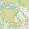
Loughrigg Fell loop from Ambleside
United Kingdom > England > Westmorland and Furness > Ambleside
Distance: 7.9 mi • Elevation gain: 489 m • Maximum elevation: 329 m

Ambleside to Rydal Loop
United Kingdom > England > Westmorland and Furness > Ambleside
Distance: 5.4 mi • Elevation gain: 252 m • Maximum elevation: 198 m

Fairfield Horseshoe Loop
United Kingdom > England > Westmorland and Furness > Ambleside
Distance: 9.9 mi • Elevation gain: 931 m • Maximum elevation: 870 m
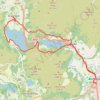
Rydal Water and Grasmere
United Kingdom > England > Westmorland and Furness > Ambleside
Distance: 9.9 mi • Elevation gain: 337 m • Maximum elevation: 140 m