Import a GPX file

Murray Bridge trails

Click on a trail to view its statistics, map and profile.

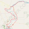
JDRF Murray River Raid

Australia > South Australia > The Rural City of Murray Bridge > Murray Bridge

#Bike #Loop

Distance: 71.4 mi • Elevation gain: 889 m • Maximum elevation: 98 m

Gear up for your next adventure:

🗺️Ordnance Survey Maps - Essential paper maps for hiking across the UK national parks
🌂Windproof Trekking Umbrellas - Surprising but effective rain protection on low-wind trails
🔋Lithium AA Batteries - Long-lasting power that performs well in cold mountain weather
🗺️Topographic Maps - Detailed maps showing elevation and terrain features
🧘Folding Sit Mats - Dry and warm seat for map-reading breaks on damp ground

As an Amazon Associate, this site earns from qualifying purchases at no extra cost to you.