
Western Connecticut Planning Region trails
Click on a trail to view its statistics, map and profile.
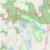
Bennett's Pond, Lake Windwing, Hemlock Hills, Pine Mountain and Wooster Mountain Loop
United States > Connecticut > Western Connecticut Planning Region > Ridgefield > Wataba Lake
Morning Ride
Distance: 12.2 mi • Elevation gain: 452 m • Maximum elevation: 299 m
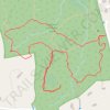
Leonard J. Bradley Park loop trails
United States > Connecticut > Western Connecticut Planning Region > Wilton
Distance: 1.4 mi • Elevation gain: 21 m • Maximum elevation: 112 m