Import a GPX file

Beaver Creek trails

Click on a trail to view its statistics, map and profile.
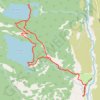
Bradley Lake and Taggart Lake Loop Trail in Grand Teton National Park

United States > Wyoming > Teton County > Moose > Beaver Creek

This loop hike to Bradley and Taggart lakes offers a fantastic blend of tranquil lakes and gorgeous views of the Tetons. With well-maintained paths and gentle elevation, it’s a great hike for those looking to enjoy a peaceful day outdoors. #Hiking #Mountain #Lake #Forest #Nature

Distance: 6.0 mi • Elevation gain: 210 m • Maximum elevation: 2,183 m
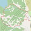
Taggart Lake Loop

United States > Wyoming > Teton County > Moose > Beaver Creek

Grand Teton National Park. #Hiking #Loop #Lake #Forest #Mountain #Nature

Distance: 3.8 mi • Elevation gain: 126 m • Maximum elevation: 2,132 m

Gear up for your next adventure:

🧤Waterproof Overmitts - Extreme weather protection for hikers and mountaineers
🛰️Handheld GPS Devices - Reliable GPS units for hiking and outdoor navigation
🥾Women's Waterproof Hiking Boots - High-performance trekking boots designed for all-weather comfort
🔋Solar Chargers - Eco-friendly charging solutions for outdoor use
📷Camera Straps - Secure straps for carrying cameras while walking

As an Amazon Associate, this site earns from qualifying purchases at no extra cost to you.