
Box trails
Click on a trail to view its statistics, map and profile.

Morgan Lakes via Little Lakes Valley Trail and Morgan Pass in Inyo National Forest
United States > California > Inyo County
The hike to Morgan Lakes via the Little Lakes Valley Trail offers an unforgettable experience in the heart of the Eastern Sierra. Starting at Mosquito Flat, the trail weaves through a stunning landscape filled with serene alpine lakes like Mack Lake, Marsh Lake, Heart Lake and Box Lake, all framed by towering…
Distance: 4.6 mi • Elevation gain: 323 m • Maximum elevation: 3,382 m
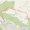
Gabrielino Trail
United States > California > Los Angeles County
Starting from Chantry Flat, the Gabrielino Trail slips from the shaded ridge above Big Santa Anita Canyon into a classic Angeles National Forest corridor of wooded slopes, creekside cabins and canyon-bottom shade. The route passes the lower canyon junctions, Cascade Picnic Area and Spruce Grove Trail Camp…
Distance: 27.6 mi • Elevation gain: 2,358 m • Maximum elevation: 1,421 m

Zorinsky Lake Loop Trail in Omaha
United States > Nebraska > Douglas County > Omaha
The Zorinsky Lake Loop Trail offers a peaceful experience for hikers and cyclists, with much of the route running along the water's edge. You’ll encounter scenic views of the lake and occasional shaded stretches through wooded areas, particularly near Boxelder Creek. The well-maintained path provides a…
Distance: 7.2 mi • Elevation gain: 100 m • Maximum elevation: 351 m

Ice Box, Falls Canyon, Bouder Canyon, Camel's Back, Punch Bowl, Rocky Hollow and Wedge Rock Loop from Suspension Bridge in Turkey Run State Park
United States > Indiana > Parke County
This hiking route through Turkey Run State Park, encompassing Ice Box, Falls Canyon, Boulder Canyon, Camel's Back, Punch Bowl, Rocky Hollow, and Wedge Rock Loop, offers an exhilarating experience for outdoor enthusiasts. This journey traverses rugged terrain marked by steep cliffs and unique geological…
Distance: 4.1 mi • Elevation gain: 139 m • Maximum elevation: 215 m
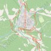
Ouray Perimeter Trail in Uncompahgre National Forest
United States > Colorado > Ouray County > Ouray
The Ouray Perimeter Trail offers hikers a scenic loop around the town of Ouray, Colorado, traversing diverse terrains including cliffs, canyons, and forested hillsides. Along the route, you'll encounter natural attractions such as Cascade Falls, the Baby Bath Tubs, and Box Canyon Falls, as well as panoramic…
Distance: 5.7 mi • Elevation gain: 525 m • Maximum elevation: 2,589 m
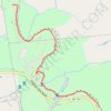
Hailes Cave Lot to Overlook via the Escarpment Trail
United States > New York > Albany County > Town of Guilderland
From Hailes Cave Lot, the route follows the Escarpment Trail along the wooded rim of John Boyd Thacher State Park, passing the Hailes Cave area and the Squeeze Box rock-climbing entrance above the Helderberg Escarpment. It continues south past Horseshoe and the Indian Ladder area, where limestone cliffs,…
Distance: 2.0 mi • Elevation gain: 98 m • Maximum elevation: 367 m

Strawberry Peak Trail in Angeles National Forest
United States > California > Los Angeles County
The Strawberry Peak Trail in Angeles National Forest offers hikers a challenging yet rewarding journey through diverse terrains. Starting from the Red Box Picnic Area, the path meanders through shaded canyons, ascends exposed ridges and rocky outcrops, culminating at the peak's distinctive, strawberry-shaped…
Distance: 7.2 mi • Elevation gain: 928 m • Maximum elevation: 1,863 m

Meccacopia and Little Box Canyon Loop
United States > California > Riverside County
From the Box Canyon Road area, this loop enters the open desert of the Mecca Hills Wilderness, where sandy tracks cross low ridges, dry washes, and eroded badlands. The route follows the Meccacopia and Little Box Canyon trail corridors through a quiet landscape shaped by folded rock, pale slopes, and sparse…
Distance: 10.2 mi • Elevation gain: 407 m • Maximum elevation: 361 m

Boynton Vista Trail via Boynton Canyon Trail in Coconino National Forest
United States > Arizona > Yavapai County
The Boynton Vista Trail in Sedona, Arizona, offers a memorable hiking experience characterized by striking red rock formations and serene desert vistas. Along the way, hikers can admire unique sandstone spires such as the Kachina Woman and Warrior Rock, landmarks steeped in natural beauty and cultural…
Distance: 1.4 mi • Elevation gain: 58 m • Maximum elevation: 1,425 m

Pine Grove Trail and Ledges Trail Loop from Kendall Lake in Cuyahoga Valley National Park
United States > Ohio > Summit County > Peninsula
The Pine Grove Trail and Ledges Trail Loop from Kendall Lake offers a delightful blend of scenic views and diverse landscapes. Hikers will traverse through lush forests filled with towering pines and hemlocks, and experience striking rock formations, particularly at the Ledges Overlook, which provides a…
Distance: 4.3 mi • Elevation gain: 101 m • Maximum elevation: 316 m


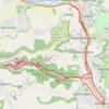
Woodchester Stroud Walking
United Kingdom > England > Gloucestershire > Nailsworth > Box
Distance: 14.1 mi • Elevation gain: 491 m • Maximum elevation: 211 m


Ice Box Canyon
United States > Nevada > Clark County
Hike to the Ice Box Canyon in the Rainbow Mountain Wilderness. #Hiking #Canyon #Mountain #Nature #Wilderness
Distance: 2.7 mi • Elevation gain: 271 m • Maximum elevation: 1,477 m

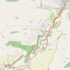
Nailsworth to Kingscote Loop
United Kingdom > England > Gloucestershire > Nailsworth > Inchbrook
Distance: 7.2 mi • Elevation gain: 273 m • Maximum elevation: 213 m

NW to Stroud
United Kingdom > England > Gloucestershire > Nailsworth > Inchbrook
Stroud Walking
Distance: 11.9 mi • Elevation gain: 451 m • Maximum elevation: 200 m
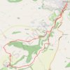
Loop walk from Nailsworth to Kingscote
United Kingdom > England > Gloucestershire > Nailsworth > Box
Distance: 7.6 mi • Elevation gain: 295 m • Maximum elevation: 213 m

Toadsmoor Valley
United Kingdom > England > Gloucestershire > Nailsworth > Box
Distance: 19.5 mi • Elevation gain: 839 m • Maximum elevation: 236 m

Gatcombe Park
United Kingdom > England > Gloucestershire > Nailsworth > Box
Distance: 13.4 mi • Elevation gain: 452 m • Maximum elevation: 194 m

Box Canyon Trail to waterfall
United States > Idaho > Fremont County > Island Park
Distance: 4.4 mi • Elevation gain: 49 m • Maximum elevation: 1,915 m
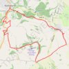
Avening loop
United Kingdom > England > Gloucestershire > Nailsworth > Box
Distance: 11.0 mi • Elevation gain: 329 m • Maximum elevation: 186 m
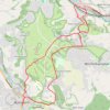
Nailsworth - Brimscombe
United Kingdom > England > Gloucestershire > Nailsworth > Box
Distance: 6.4 mi • Elevation gain: 322 m • Maximum elevation: 205 m
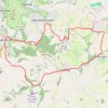
Nailsworth to Cherington loop
United Kingdom > England > Gloucestershire > Nailsworth > Box
Distance: 11.3 mi • Elevation gain: 403 m • Maximum elevation: 191 m

Occidental Peak Trail
United States > California > Los Angeles County > Mount Wilson
Distance: 2.1 mi • Elevation gain: 159 m • Maximum elevation: 1,709 m

Kingscote Glos
United Kingdom > England > Gloucestershire > Nailsworth > Box
Distance: 11.3 mi • Elevation gain: 357 m • Maximum elevation: 224 m
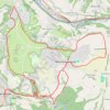
Minchinhampton loop
United Kingdom > England > Gloucestershire > Nailsworth > Box
Distance: 13.1 mi • Elevation gain: 414 m • Maximum elevation: 205 m

Stroud direct
United Kingdom > England > Gloucestershire > Nailsworth > Box
Distance: 10.0 mi • Elevation gain: 301 m • Maximum elevation: 205 m

Ledges Trail hike
United States > Ohio > Summit County > Boston Heights
Distance: 3.3 mi • Elevation gain: 108 m • Maximum elevation: 322 m

Avening
United Kingdom > England > Gloucestershire > Nailsworth > Box
Distance: 6.1 mi • Elevation gain: 258 m • Maximum elevation: 193 m

Boxford Price Property
United States > Massachusetts > Essex County > Boxford
Distance: 1.5 mi • Elevation gain: 21 m • Maximum elevation: 41 m

Groton Wood Nature Reserve
United Kingdom > England > Suffolk > Babergh > Groton
Distance: 0.9 mi • Elevation gain: 15 m • Maximum elevation: 72 m