Import a GPX file

Saint-Pierre trails

Click on a trail to view its statistics, map and profile.
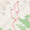
2015-07-19 Mt Fallere

Italy > Aosta Valley > Saint-Pierre > Vetan Villette

Mt Fallere vanuit Vetan 6,5h 1400m up and down 19km

Distance: 11.3 mi • Elevation gain: 1,457 m • Maximum elevation: 3,029 m
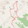
2015-07-19 Mt Fallere

Italy > Aosta Valley > Saint-Pierre > Vetan Villette

Distance: 11.3 mi • Elevation gain: 1,454 m • Maximum elevation: 3,028 m

Other places

Gear up for your next adventure:

📚UK Hiking Guidebooks - Detailed route descriptions for the Lake District, Peaks, and Highlands
🗺️Topographic Maps - Detailed maps showing elevation and terrain features
🔋Rechargeable Batteries - Eco-friendly power for headlamps and older GPS units
⛺Lightweight Tents - Compact tents for backpacking and trekking
🧘Folding Sit Mats - Dry and warm seat for map-reading breaks on damp ground

As an Amazon Associate, this site earns from qualifying purchases at no extra cost to you.