
Pašina voda trails
Click on a trail to view its statistics, map and profile.
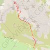
Bobotov Kuk from Sedlo pass montenegro hike
Montenegro > Žabljak Municipality > Pašina voda > Pošćenski katun
Distance: 3.8 mi • Elevation gain: 789 m • Maximum elevation: 2,421 m
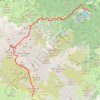
MNE-3: Sedlo - Bobotov kuk - Ice Cave - Crno jezero
Montenegro > Žabljak Municipality > Pašina voda > Pošćenski katun
Distance: 9.0 mi • Elevation gain: 985 m • Maximum elevation: 2,416 m
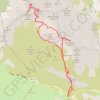
Durmitor: Bobotov kuk i Bandijerna.
Montenegro > Žabljak Municipality > Pašina voda > Pošćenski katun
Distance: 8.2 mi • Elevation gain: 1,316 m • Maximum elevation: 2,417 m