Import a GPX file

Devici trails

Click on a trail to view its statistics, map and profile.
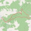
Девићи - Водопади Изубре

Serbia > Central Serbia > Moravica Administrative District > Ivanjica Municipality > Devici

Distance: 6.8 mi • Elevation gain: 579 m • Maximum elevation: 1,170 m

Gear up for your next adventure:

🔋Power Banks - Portable chargers for long outdoor trips
📍Handheld GPS Navigators - Reliable satellite navigation for hiking and off-road exploration
🔦Keychain LED Torches - Emergency backup light for finding gear in your pack
🧺Mesh Stuff Sacks - Breathable storage for wet gear or camp organization
🌂Windproof Trekking Umbrellas - Surprising but effective rain protection on low-wind trails

As an Amazon Associate, this site earns from qualifying purchases at no extra cost to you.