Import a GPX file

Langbank Holdings trails

Click on a trail to view its statistics, map and profile.
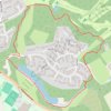
Trails around Milngavie

United Kingdom > Scotland > East Dunbartonshire > Milngavie > Langbank Holdings

Distance: 1.7 mi • Elevation gain: 42 m • Maximum elevation: 75 m

Gear up for your next adventure:

🧭Emergency Beacons - Safety beacons for remote outdoor locations
🔦Outdoor Torches - Reliable torches for night navigation
☕Insulated Travel Mugs - Keep drinks hot while surveying the landscape from a summit
🧣Fleece Neck Warmers - Extra insulation for winter topographic surveys
🧺Microfibre Travel Towels - Fast-drying and compact towels for wild swimming and camping

As an Amazon Associate, this site earns from qualifying purchases at no extra cost to you.