
Ryker trails
Click on a trail to view its statistics, map and profile.
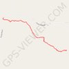
Whitaker Point Trail to Hawksbill Crag in Ozark-St. Francis National Forest
United States > Arkansas > Newton County > Ryker
The Whitaker Point Trail offers a captivating journey through the lush landscapes of the Ozark-St. Francis National Forest, leading to the iconic Hawksbill Crag. Hikers will experience a variety of natural features, including dense forests, rocky outcrops, and stunning panoramic views of the surrounding…
Distance: 2.7 mi • Elevation gain: 139 m • Maximum elevation: 669 m