Import a GPX file

Carlton trails

Click on a trail to view its statistics, map and profile.
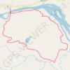
Silver Creek Loop Trail in Jay Cooke State Park

United States > Minnesota > Carlton County > Carlton

The Silver Creek Loop Trail offers a memorable outdoor experience, showcasing a variety of natural elements. Hikers are greeted with picturesque views of the St. Louis River and Silver Creek, as well as sections of dense hardwood forests filled with birch and basswood trees. Along the route, the landscape…

Distance: 3.4 mi • Elevation gain: 92 m • Maximum elevation: 294 m
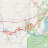
Minnesota Voyageur Trail Ultramarathon

United States > Minnesota > Carlton County > Carlton

Minnesota Voyageur 50 mi. #Trail #Ultra #Running #Nature #Forest

Distance: 49.5 mi • Elevation gain: 1,405 m • Maximum elevation: 381 m

Gear up for your next adventure:

🗺️Scratch-off Peak Maps - Track your progress climbing Munros or Wainwrights
📱Rugged Phone Cases - Heavy-duty protection for smartphones used as secondary GPS tools
🧥Breathable Waterproof Jackets - Essential rain protection for the unpredictable British climate
🛌Sleeping Mats - Insulated mats for comfortable outdoor sleeping
🚲Cycling GPS Computers - Track elevation and topographic routes on two wheels

As an Amazon Associate, this site earns from qualifying purchases at no extra cost to you.