Import a GPX file

Sulphur Springs trails

Click on a trail to view its statistics, map and profile.
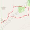
Alamao Canyon Loop in Valles Caldera National Preserve

United States > New Mexico > Sandoval County > Sulphur Springs

Distance: 11.9 mi • Elevation gain: 518 m • Maximum elevation: 2,871 m

Gear up for your next adventure:

🧦Hiking Socks - Breathable socks designed to prevent blisters on long walks
🧭Orienteering Compasses - Accurate compasses for map-based navigation
🔭Compact Hiking Binoculars - Lightweight optics for scouting terrain and spotting wildlife
🎿Telescopic Trekking Poles - Reduces knee strain on steep topographic descents
🎒Replacement Sternum Straps - Repair parts for hiking rucksacks

As an Amazon Associate, this site earns from qualifying purchases at no extra cost to you.