
Peckham Ranch trails
Click on a trail to view its statistics, map and profile.
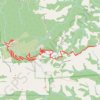
Mount Umunhum
United States > California > Santa Clara County > Peckham Ranch
Starting at Bald Mountain Parking Area in Sierra Azul Open Space Preserve, the route follows Mount Umunhum Trail westward through mixed chaparral, knobcone pine, coast live oak, California bay, and madrone, with openings toward Santa Clara Valley and the surrounding ridges. The itinerary then passes the…
Distance: 7.5 mi • Elevation gain: 633 m • Maximum elevation: 1,046 m