Import a GPX file

Thunder Bay trails

Click on a trail to view its statistics, map and profile.

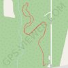
Kamview Nordic Ski Centre

Canada > Ontario > Thunder Bay District > Thunder Bay

#Ski #Snowshoeing

Distance: 2.1 mi • Elevation gain: 27 m • Maximum elevation: 242 m

Kamview Nordic Ski Centre

Canada > Ontario > Thunder Bay District > Thunder Bay

Distance: 2.1 mi • Elevation gain: 27 m • Maximum elevation: 242 m
Gear up for your next adventure:

🥤Collapsible Water Bottles - Save space in your rucksack as you consume your water
🐕Dog Hiking Gear - Equipment for hiking safely with dogs
❄️Walking Crampons - Added traction for icy slopes and winter peak bagging
👟Waterproof Leg Gaiters - Keep mud and water out of your boots in boggy terrain
📱Rugged Phone Cases - Heavy-duty protection for smartphones used as secondary GPS tools

As an Amazon Associate, this site earns from qualifying purchases at no extra cost to you.