Import a GPX file

Bidasoa Beherea / Bajo Bidasoa trails

Click on a trail to view its statistics, map and profile.
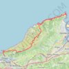
Hondarribia - Pasaia

Spain > Autonomous Community of the Basque Country > Bidasoa Beherea / Bajo Bidasoa > Hondarribia

Distance: 13.2 mi • Elevation gain: 862 m • Maximum elevation: 430 m

Other places

Gear up for your next adventure:

🔋Solar Power Banks - Keep your GPS and phone charged during multi-day expeditions
🔥Reusable Hand Warmers - Maintain dexterity in your fingers for precise map handling
🧦Merino Wool Hiking Socks - Moisture-wicking socks to prevent blisters during long mountain walks
📍Handheld GPS Navigators - Reliable satellite navigation for hiking and off-road exploration
🔭Compact Hiking Binoculars - Lightweight optics for scouting terrain and spotting wildlife

As an Amazon Associate, this site earns from qualifying purchases at no extra cost to you.