Import a GPX file

Luk Wu trails

Click on a trail to view its statistics, map and profile.
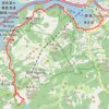
獅子頭山 蓮花台麒麟石 大鐵鎚石 昂坪

China > Hong Kong > Islands District > Luk Wu

Distance: 4.9 mi • Elevation gain: 528 m • Maximum elevation: 679 m

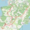
獅子頭南坑左 獅子頭坑 昂深下源 深石坑

China > Hong Kong > Islands District > Luk Wu

Islands District Hike

Distance: 9.5 mi • Elevation gain: 590 m • Maximum elevation: 311 m
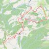
深坑瀝小路

China > Hong Kong > Islands District > Luk Wu

Distance: 10.3 mi • Elevation gain: 726 m • Maximum elevation: 462 m
Gear up for your next adventure:

🧣Fleece Neck Warmers - Extra insulation for winter topographic surveys
🚲Cycling GPS Computers - Track elevation and topographic routes on two wheels
🦯Walking Poles - Supportive poles for long-distance walking
👟Men's Trail Running Shoes - Lightweight grip for fast movement over topographic contours
🗺️Ordnance Survey Maps - Essential paper maps for hiking across the UK national parks

As an Amazon Associate, this site earns from qualifying purchases at no extra cost to you.