Import a GPX file

United States Virgin Islands trails

Click on a trail to view its statistics, map and profile.
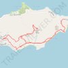
Trail near Point Udal connecting to GrapeTree

United States > United States Virgin Islands > Saint Croix District > North Grapetree Bay

Distance: 6.4 mi • Elevation gain: 385 m • Maximum elevation: 185 m

Other places

Gear up for your next adventure:

🎒Backpack Rain Covers - Universal waterproof covers to protect your gear from downpours
🛌Insulated Sleeping Mats - Crucial thermal protection when sleeping on cold, uneven ground
🚲Cycling GPS Computers - Track elevation and topographic routes on two wheels
🧼Biodegradable Soap - Leave-no-trace hygiene for multi-day mountain treks
👕Technical Hiking Tees - Moisture-management for high-exertion climbs

As an Amazon Associate, this site earns from qualifying purchases at no extra cost to you.