Import a GPX file

Brundall trails

Click on a trail to view its statistics, map and profile.
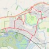
Brundall & Blofield loop walk

United Kingdom > England > Norfolk > Broadland > Brundall

walking, brundall, blofield

Distance: 6.9 mi • Elevation gain: 90 m • Maximum elevation: 25 m

Gear up for your next adventure:

🍲Portable Camping Stoves - Fast-boiling stoves for hot meals on remote topographic survey trips
🗺️Ordnance Survey Maps - Essential paper maps for hiking across the UK national parks
📢Survival Whistles - Essential safety gear for signaling for help in mountain fog
🔋Lithium AA Batteries - Long-lasting power that performs well in cold mountain weather
👕Merino Base Layers - Natural temperature regulation for cold weather hiking and camping

As an Amazon Associate, this site earns from qualifying purchases at no extra cost to you.