Import a GPX file

Brook Forest trails

Click on a trail to view its statistics, map and profile.

Maxwell Falls Loop via Maxwell Falls Bluffs Trail in Arapaho National Forest

United States > Colorado > Jefferson County > Evergreen > Brook Forest

The Maxwell Falls Loop via the Maxwell Falls Bluffs Trail in Arapaho National Forest offers a scenic hike through dense pine forests and alongside Maxwell Creek, culminating in views of the cascading falls. The trail provides a balance of tranquil woodland paths and rugged terrain, with rocky sections that add…

Distance: 4.8 mi • Elevation gain: 327 m • Maximum elevation: 2,566 m
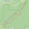
Maxwell Falls Loop

United States > Colorado > Jefferson County > Evergreen > Brook Forest

Arapaho National Forest. #Hiking #Loop #Waterfall #River #Forest #Mountain #Nature

Distance: 3.9 mi • Elevation gain: 256 m • Maximum elevation: 2,556 m

Gear up for your next adventure:

🔦LED Camping Lanterns - Illumination for reading maps inside your tent at night
🧰First Aid Kits - Essential safety kits for outdoor activities
🔦Head Torches - Hands-free lighting for hiking and camping
🗺️Topographic Maps - Detailed maps showing elevation and terrain features
🛰️Satellite Messengers - Emergency communication devices for areas without mobile signal

As an Amazon Associate, this site earns from qualifying purchases at no extra cost to you.