Import a GPX file

Town of Richmond trails

Click on a trail to view its statistics, map and profile.
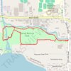
Sandy Bottom Park Nature Loop Trail

United States > New York > Ontario County > Town of Richmond > Honeoye

Distance: 2.5 mi • Elevation gain: 25 m • Maximum elevation: 262 m

Other places

Gear up for your next adventure:

🦟Anti-Midge & Tick Repellent - Vital for hiking in the Scottish Highlands during summer
🧥Packable Down Jackets - Lightweight warmth that compresses small in your bag
🛰️Handheld GPS Devices - Reliable GPS units for hiking and outdoor navigation
🔋Solar Power Banks - Keep your GPS and phone charged during multi-day expeditions
🌦️Portable Weather Meters - Handheld tools for monitoring weather conditions

As an Amazon Associate, this site earns from qualifying purchases at no extra cost to you.