Import a GPX file

Plumpton Green trails

Click on a trail to view its statistics, map and profile.
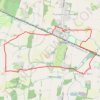
Plumpton Green, Streat and East Chiltington loop walk

United Kingdom > England > East Sussex > Lewes > Plumpton Green

Distance: 5.3 mi • Elevation gain: 72 m • Maximum elevation: 72 m

Gear up for your next adventure:

🗺️Ordnance Survey Maps - Essential paper maps for hiking across the UK national parks
🧭GPS Trackers - Tracking devices for safety and navigation
🧵Survival Paracord - Multi-purpose cordage for emergency repairs and shelters
🥾Walking Shoes - Lightweight walking shoes for countryside and coastal paths
📦Compression Sacks - Reduce backpack volume efficiently

As an Amazon Associate, this site earns from qualifying purchases at no extra cost to you.