Import a GPX file

Halfmoon Bay trails

Click on a trail to view its statistics, map and profile.
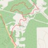
Homesite Creek Loop Walk

Canada > British Columbia > Sunshine Coast Regional District > Area B (Halfmoon Bay) > Halfmoon Bay

Distance: 4.1 mi • Elevation gain: 160 m • Maximum elevation: 175 m

Gear up for your next adventure:

🧣Neck Gaiters - Protects against wind and sun on exposed ridges and peaks
🗺️Topographic Maps - Detailed maps showing elevation and terrain features
🧭GPS Trackers - Tracking devices for safety and navigation
🥾Women's Waterproof Hiking Boots - High-performance trekking boots designed for all-weather comfort
🧥Waterproof Hiking Jackets - Rain protection for walking in all weather conditions

As an Amazon Associate, this site earns from qualifying purchases at no extra cost to you.