
Mount Katahdin Township trails
Click on a trail to view its statistics, map and profile.

Mount Katahdin and Hamlin Peak Loop
United States > Maine > Piscataquis County > Mount Katahdin Township
Loop hike to Mount Katahdin and Hamlin Peak via Chimney Pond Trail, Helon Taylor Trail, Pamola, Knife Edge Trail, Chimney Peak, South Peak, Baxter Peak, Saddle Trail, Northwest Basin Trail, Caribou Spring, Hamlin Ridge Trail, Hamlin Peak, North Basin Trail, North Basin Cut-Off and Basin Ponds in the Baxter…
Distance: 10.1 mi • Elevation gain: 1,311 m • Maximum elevation: 1,586 m
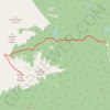
Baxter Peak - Mount Katahdin
United States > Maine > Piscataquis County > Mount Katahdin Township
Saddle Trail, Baxter State Park. #Hiking
Distance: 5.5 mi • Elevation gain: 1,144 m • Maximum elevation: 1,590 m