Import a GPX file

Hayfield trails

Click on a trail to view its statistics, map and profile.
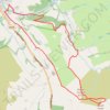
Mount Famine and South Head loop hike from Hayfield

United Kingdom > England > Derbyshire > High Peak > Hayfield

Distance: 5.7 mi • Elevation gain: 416 m • Maximum elevation: 489 m

Gear up for your next adventure:

🔋Solar Power Banks - Keep your GPS and phone charged during multi-day expeditions
🧤Waterproof Overmitts - Extreme weather protection for hikers and mountaineers
🥾Women's Waterproof Hiking Boots - High-performance trekking boots designed for all-weather comfort
🧭GPS Trackers - Tracking devices for safety and navigation
❄️Walking Crampons - Added traction for icy slopes and winter peak bagging

As an Amazon Associate, this site earns from qualifying purchases at no extra cost to you.