Import a GPX file

Pitt Meadows trails

Click on a trail to view its statistics, map and profile.
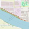
Pitt Meadows Regional Greenway

Canada > British Columbia > Metro Vancouver Regional District > Pitt Meadows

Harris Landing Park. Shoreline Park. Fraser River. #Hiking #MTB #Running #HarrisLanding

Distance: 2.3 mi • Elevation gain: 17 m • Maximum elevation: 11 m

Gear up for your next adventure:

🧣Neck Gaiters - Protects against wind and sun on exposed ridges and peaks
🗺️Topographic Maps - Detailed maps showing elevation and terrain features
🧘Folding Sit Mats - Dry and warm seat for map-reading breaks on damp ground
🛰️Satellite Messengers - Emergency communication devices for areas without mobile signal
⛺Lightweight Tents - Compact tents for backpacking and trekking

As an Amazon Associate, this site earns from qualifying purchases at no extra cost to you.