Import a GPX file

Malmedy trails

Click on a trail to view its statistics, map and profile.
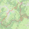
Naar de Neus van Napoleon

Belgium > Liège > Verviers > Malmedy > Longfaye

<p>Deze avontuurlijke wandeling langs de Warche brengt je naar het beroemde uitzichtspunt, de Neus van Napoleon. Hoe dat uitzichtspunt aan de naam kwam ontdek je op deze route.</p>

Distance: 8.3 mi • Elevation gain: 459 m • Maximum elevation: 523 m

Other places

Gear up for your next adventure:

🛰️Handheld GPS Devices - Reliable GPS units for hiking and outdoor navigation
👖Convertible Hiking Trousers - Versatile zip-off pants for changing mountain weather conditions
🔥Reusable Hand Warmers - Maintain dexterity in your fingers for precise map handling
🍳Camping Stoves - Compact stoves for outdoor cooking
🕶️Glacier Goggles - Maximum protection for high-altitude snow topography

As an Amazon Associate, this site earns from qualifying purchases at no extra cost to you.